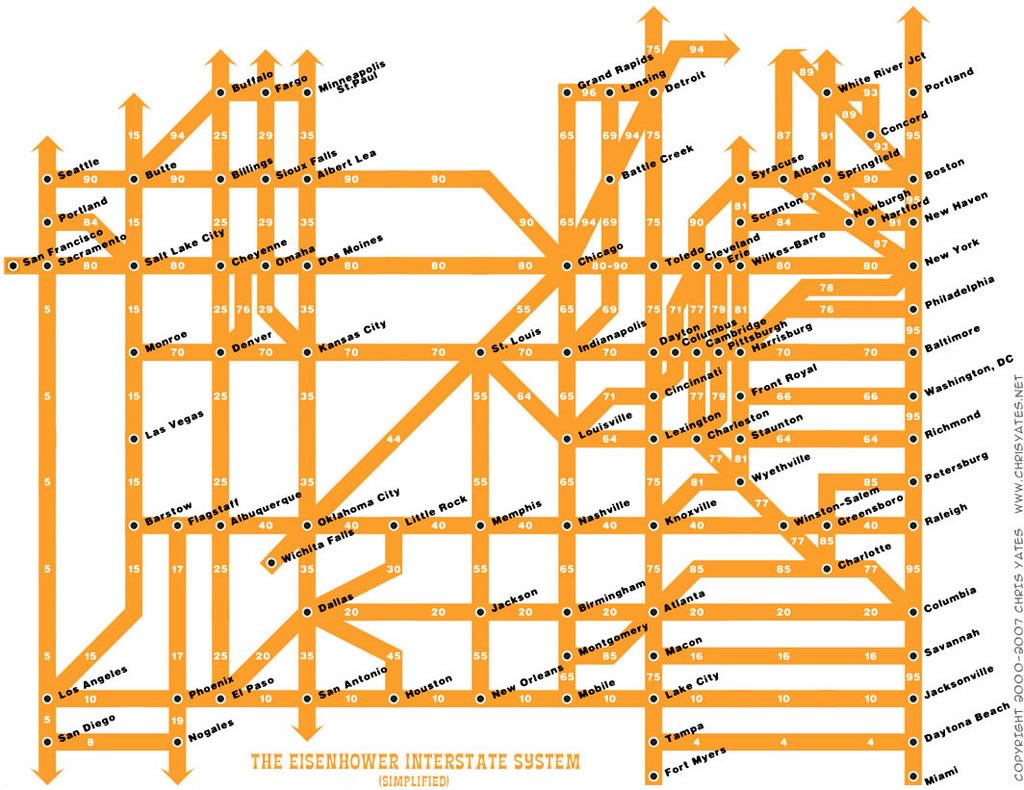
For those of you who do a lot of road-tripping in the U.S., here’s something that you might find interesting — a map of the U.S. Interstate highway system, simplified in a fashion similar to many subway maps:
Click the map to see it at full size.
Map courtesy of Miss Fipi Lele.
This map is a creation of Chris Yates, and you can get prints of it from the “Toys” page of his site.
5 replies on “Simplified Interstate System Map”
[…] » Simplified Interstate System Map » The Adventures of Accordion Guy in the 21st Century […]
I 75 should also connect to Miami.
Looks like the Interstates never go through Wisconsin if you followed this map! In fact, it appears I-94 goes off into never-never-land from Minnesota.
I wonder when this map was made. There’s no mention whatsoever of I-74, which links at least Cincinnati, Indianapolis, and Davenport at this time. I have heard of plans to finish the link to the east coast in North Carolina.
[…] to ease road congestionDaniels, Obama look to road construction for jobsMouse here for Related LinksSimplified Interstate System MapArticle source: […]