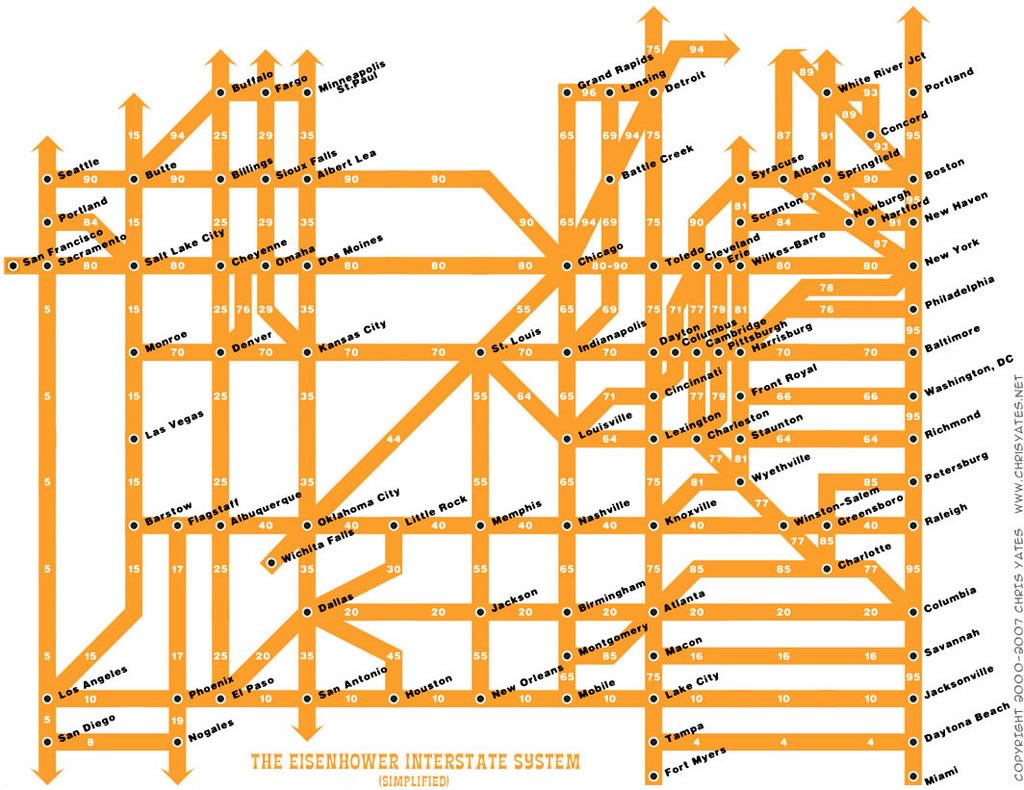
For those of you who do a lot of road-tripping in the U.S., here’s something that you might find interesting — a map of the U.S. Interstate highway system, simplified in a fashion similar to many subway maps:
Click the map to see it at full size.
Map courtesy of Miss Fipi Lele.
This map is a creation of Chris Yates, and you can get prints of it from the “Toys” page of his site.
It’s Sunday, and it’s time for another “picdump!” Here are the memes, pictures, and cartoons…
https://www.youtube.com/shorts/AvuwH_KyiKY Maybe it’s just me, or perhaps it’s the song itself, but I find that…
Bonus picdump! Here are 99 pics, comics, and memes about the current algae-infested state of…
It’s Sunday, and it’s time for another “picdump!” Here are the memes, pictures, and cartoons…
It’s Sunday, and it’s time for another “picdump!” Here are the memes, pictures, and cartoons…
It’s Sunday, and it’s time for another “picdump!” Here are the memes, pictures, and cartoons…
View Comments
I 75 should also connect to Miami.
Looks like the Interstates never go through Wisconsin if you followed this map! In fact, it appears I-94 goes off into never-never-land from Minnesota.
I wonder when this map was made. There's no mention whatsoever of I-74, which links at least Cincinnati, Indianapolis, and Davenport at this time. I have heard of plans to finish the link to the east coast in North Carolina.